Northern California and Western Nevada are preparing for a strong winter storm that is expected to hit starting Sunday. The National Weather Service Reno has issued a warning for residents in these areas, especially those living in the Sierra and Tahoe Basin regions. Let’s break down what’s happening, what to expect, and how to stay safe.
Current Weather Situation: Calm Before the Storm
Right now, there’s a short break from the stormy weather. Saturday has brought cool temperatures and mostly cloudy skies. However, this calm period will not last long. By Sunday afternoon, strong winds are expected to return, and the storm will begin to intensify.
Strong Winds Expected: Up to 60 mph Gusts
The most noticeable change on Sunday will be the strong winds sweeping through Northern California and Western Nevada. According to weather experts, wind gusts could reach up to 60 miles per hour, especially in areas north and east of Carson City.
These strong winds could create hazardous conditions, particularly for high-profile vehicles like trucks, buses, and RVs. Drivers should be extra careful and, if possible, avoid traveling during these peak wind hours.
Heavy Snowfall Starting Sunday Afternoon
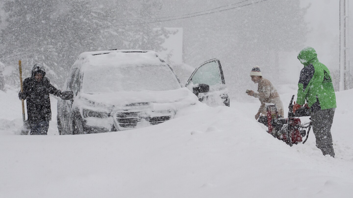
In addition to the high winds, heavy snowfall is on the way. Snow is expected to begin in northeastern California by Sunday afternoon and will move towards the Tahoe Basin before sunset.
Weather experts are predicting up to two feet of snow along the Sierra crest by Monday. This significant snowfall could create dangerous driving conditions, road closures, and travel delays. The snowfall will continue through Monday, making travel difficult, especially on mountain passes and highways.
Travel Disruptions Likely
The combination of strong winds and heavy snow is a recipe for travel troubles. People planning to travel in or through Northern California and Western Nevada on Sunday and Monday should be prepared for:
- Reduced visibility due to blowing snow
- Icy and slippery roads
- Possible road closures
- Delays and hazardous driving conditions for high-profile vehicles
Officials recommend that people avoid unnecessary travel during this time. If you must drive, make sure your vehicle is winter-ready and keep emergency supplies like blankets, food, and water.
Cool Temperatures Continue Into Tuesday
After the snowfall and strong winds ease up on Monday night, cooler temperatures will continue into Tuesday. The cold air will stick around, keeping conditions chilly and winter-like.
However, weather experts say there may be a slight warm-up by midweek, but that will depend on how quickly the storm system moves out of the region.
What Residents Should Do: Safety Tips
If you live in the affected areas, here are some simple but important safety tips to follow:
- Stay Updated: Keep checking updates from the National Weather Service or your local news for the latest storm details.
- Avoid Travel: Postpone travel plans, especially in mountain areas or if you drive a large vehicle.
- Prepare Your Vehicle: If you need to drive, check your tires, windshield wipers, and keep chains handy.
- Stock Essentials: Make sure you have enough food, water, batteries, and warm clothing at home in case of power outages or road closures.
- Stay Indoors: During the worst of the storm, it’s safer to stay inside and avoid going out unless absolutely necessary.
Looking Ahead
The winter season is not over yet, and this storm reminds us how quickly conditions can change. Northern California and Western Nevada residents should stay alert, especially when the National Weather Service issues warnings like this.
Although the weather may slightly improve midweek, it’s important to be cautious and prepared for more winter weather events over the next few weeks.
Final Word
This winter storm is bringing a powerful mix of strong winds, heavy snow, and cold temperatures to Northern California and Western Nevada. With winds up to 60 mph and snowfall reaching two feet in the mountains, travel is expected to be risky.
Stay safe, stay informed, and avoid unnecessary trips until the storm passes. Always follow official guidance from weather services and local authorities.
Disclaimer – Our team has carefully fact-checked this article to make sure it’s accurate and free from any misinformation. We’re dedicated to keeping our content honest and reliable for our readers.