A significant weather system is brewing, with the potential for severe thunderstorms to impact several parts of the United States, including Arkansas, Missouri, Illinois, and other neighboring states. This weather outbreak is expected to unfold through the weekend, bringing with it dangerous conditions such as strong winds, large hail, frequent lightning, and the possibility of tornadoes.
As of the latest updates, a large storm system is gradually organizing, and its impact will be felt from the Gulf States up into the Central States. Let’s dive into what you can expect over the next few days and how to stay safe.
The Formation of a Springtime Storm System
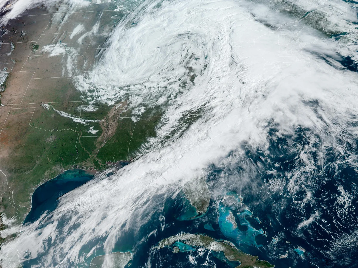
Weather experts have been closely monitoring a developing low-pressure system that is set to intensify as it moves out of the Rocky Mountains. This system will eventually merge with other weather components, forming a potent storm system typical of spring weather.
The system’s first noticeable effect will be a warm front that has already stretched along the Great Lakes and the Ohio Valley region. This warm front will help boost temperatures in several areas, including New York City, where highs near 80°F are expected tomorrow. Meanwhile, areas like Texas and Oklahoma will begin to experience heavy showers and thunderstorms as moisture from Mexico and the Gulf of Mexico feeds into the system.
The big change will come when the low-pressure system from the Rockies takes over, bringing widespread severe weather risks across a large swath of the country, starting tomorrow and lasting into Monday. However, the peak of the severe weather threat is expected late Sunday night and early Monday morning.
States Affected by Severe Weather
Severe weather will stretch across a wide region, with the highest risk zones covering parts of Texas, Louisiana, Arkansas, Missouri, Mississippi, Tennessee, Kentucky, Illinois, and Indiana. People in these areas should stay alert as the system continues to develop.
Key Threats to Watch Out For:
- Strong Thunderstorms: As this storm system moves, it will bring widespread thunderstorms, some of which will be severe. These storms can produce strong wind gusts, large hail, and flash flooding.
- Damaging Winds: Winds associated with these thunderstorms could become severe, causing damage to buildings, trees, and power lines.
- Large Hail: Hailstones large enough to cause significant damage to vehicles, crops, and homes are a possibility, particularly in the strongest storms.
- Frequent Lightning: Lightning strikes from these storms will be intense, posing a risk of wildfires and electrical damage.
- Tornadoes: Although the primary threats are damaging winds and hail, the storm system could also generate tornadoes, which are common during springtime storms in the U.S. Residents should stay prepared for possible tornado warnings, especially in areas like Arkansas, Missouri, and Illinois.
Timeline of the Storm System
This developing weather system will unfold over the next several days, with the primary threat starting tomorrow and continuing through Monday. Here’s a quick look at the expected timeline:
- Friday, March 28: The first signs of severe weather will begin to appear, particularly in the western regions of Texas and Oklahoma. These areas could see heavy rain and thunderstorms as the system starts to form.
- Saturday, March 29: As the storm system intensifies, the risk for severe weather will expand to include parts of Arkansas, Louisiana, and Missouri. Expect strong thunderstorms to become more widespread.
- Sunday, March 30: The system will reach its peak, with severe thunderstorms likely in parts of Illinois, Indiana, and Kentucky. The potential for tornadoes increases during the late evening and early morning hours.
- Monday, March 31: The storm system will continue to move northeast, bringing heavy rain and thunderstorms to areas such as Ohio and parts of the Great Lakes.
Safety Tips for Severe Weather
If you live in or around the areas affected by the storm system, it is crucial to take steps to protect yourself and your family. Here are a few tips:
- Stay Informed: Keep an eye on weather forecasts and updates from local authorities. Make sure you have access to reliable sources, such as a weather app or NOAA weather radio, for real-time information.
- Prepare an Emergency Kit: In case of power outages or other emergencies, it’s important to have an emergency kit ready. Include essentials like bottled water, non-perishable food, medications, flashlights, and a battery-powered radio.
- Know Your Safe Zone: If you are in a tornado-prone area, identify a safe room or basement where you can take shelter if necessary. Avoid windows and stay low to the ground.
- Have a Plan: Ensure that everyone in your household knows what to do in case of severe weather. This includes having an evacuation plan if you live in a flood-prone area.
- Drive Carefully: If you must travel, be aware of the potential for flooded roads and reduced visibility due to heavy rain. Avoid driving through flooded areas and stay off the roads if conditions worsen.
Conclusion
The weather system expected to impact much of the central U.S. this weekend is one to watch closely. With severe thunderstorms, damaging winds, and the potential for tornadoes, it’s important to stay prepared and informed. If you live in affected areas, make sure to take safety precautions to protect yourself and your loved ones. Stay tuned for updates, and remember to always err on the side of caution when it comes to severe weather.
Disclaimer – Our team has carefully fact-checked this article to make sure it’s accurate and free from any misinformation. We’re dedicated to keeping our content honest and reliable for our readers.